Industry
Items within the collection
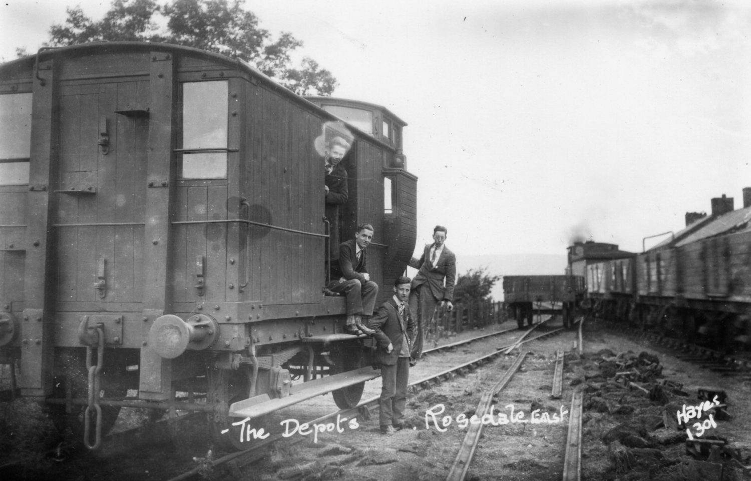
This photograph depicts the goods station at Rosedale East. The railway linked the eastern mines to the main Rosedale line by looping around the end of the dale and coming back on itself until it met the Blakey Junction. This section of railway was removed in 1929, the year of this photograph, along with the rest of the Rosedale system.
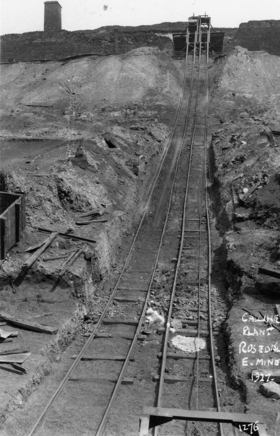
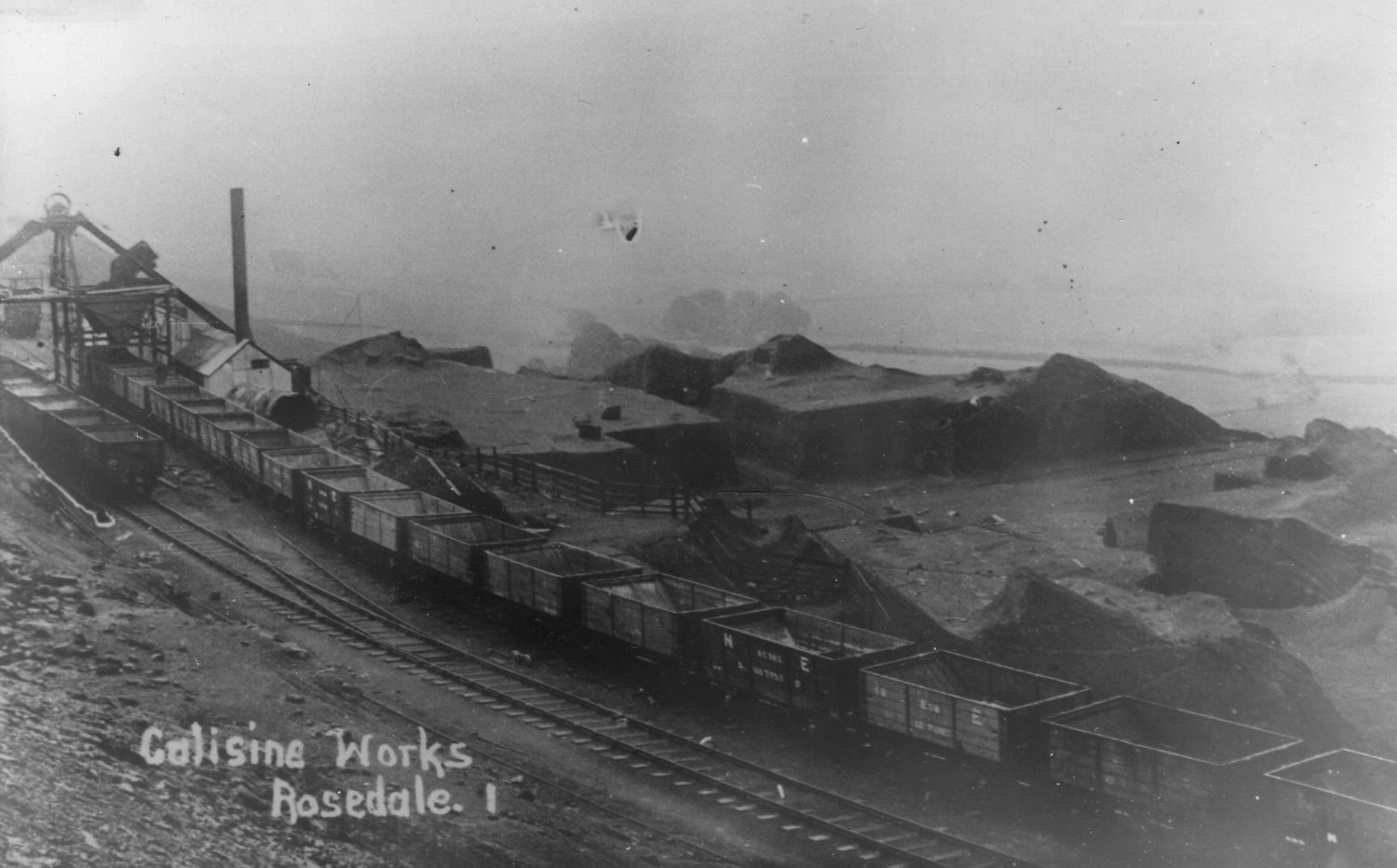
Iron ore can occur as both a carbonate and as an oxide. The carbonate ores needed to be roasted before they could be smelted to produce iron or steel. Calcine waste was produced from this process, and the tracks in this photograph show how that was carried away from the kilns.
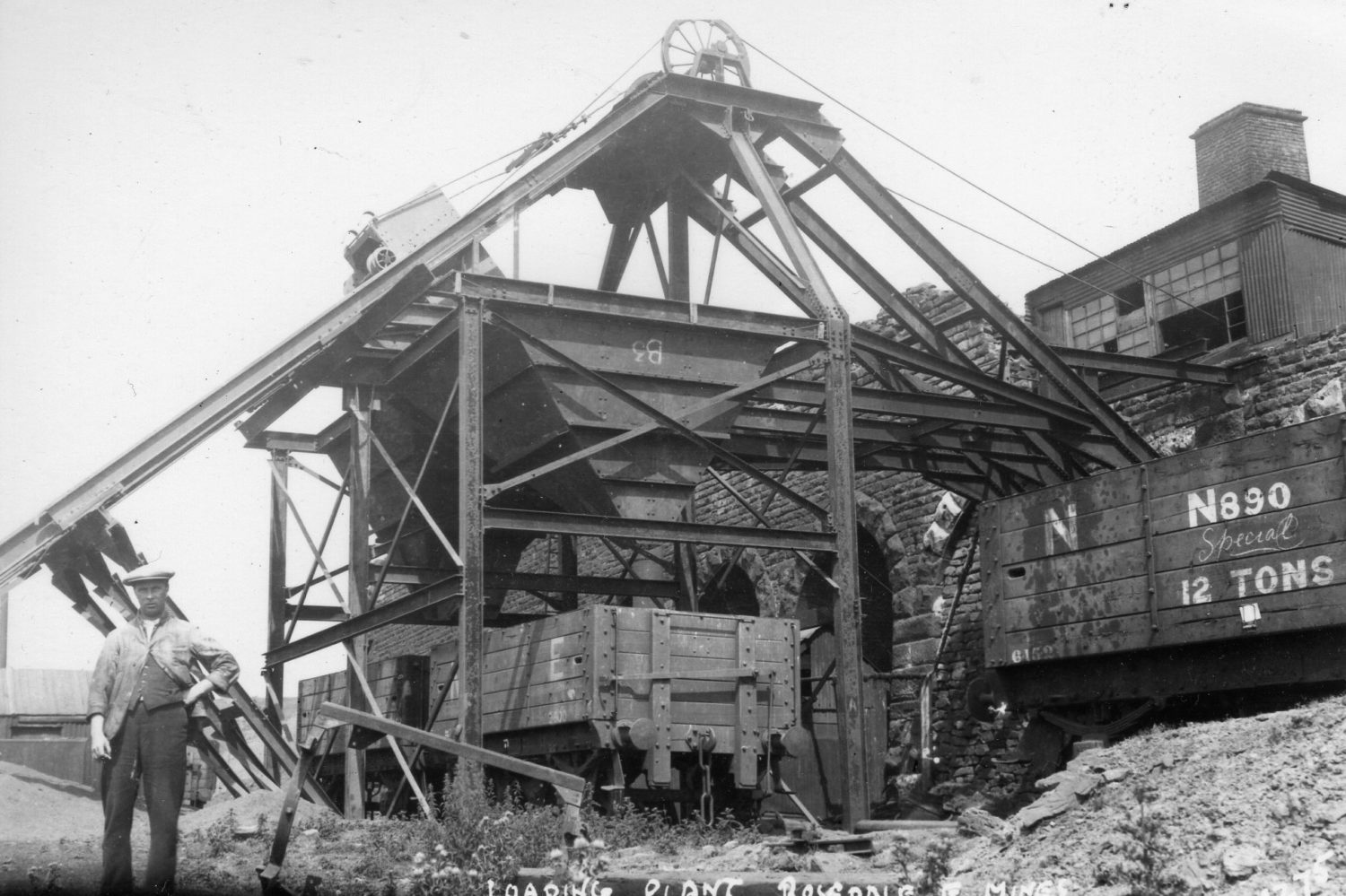
Here we see the mechanisms used to transfer iron ore and other outputs of the mining process into rail wagons, in order to transport them back to the main Rosedale line. An example of the ’12 Ton’ carts used on the line can be seen to the right.
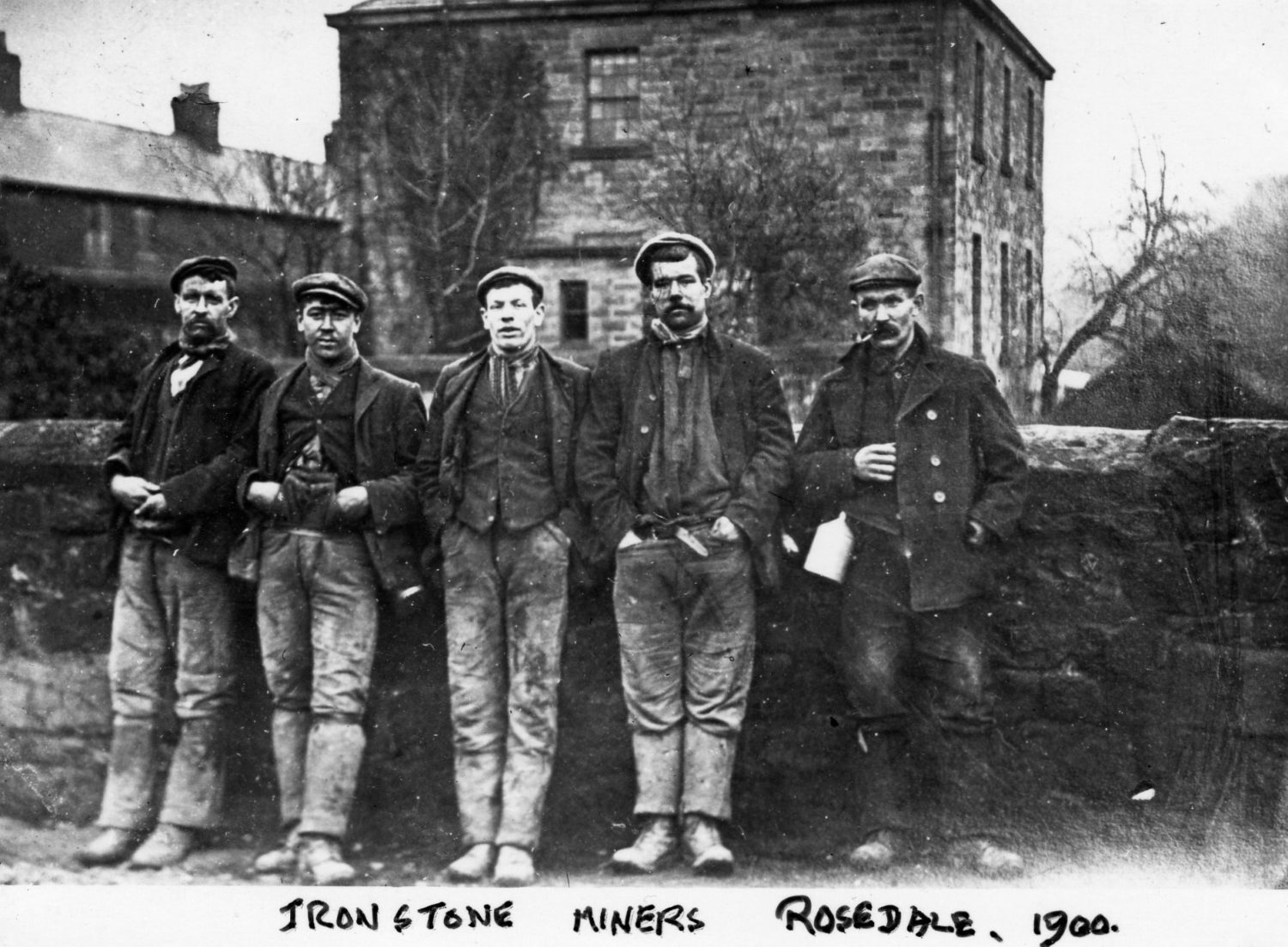
Five mine workers from Rosedale are pictured wearing their working clothes. The Ironstone mines were a booming industry for the Rosedale area, and workers came from all over Britain and even sometimes further afield.
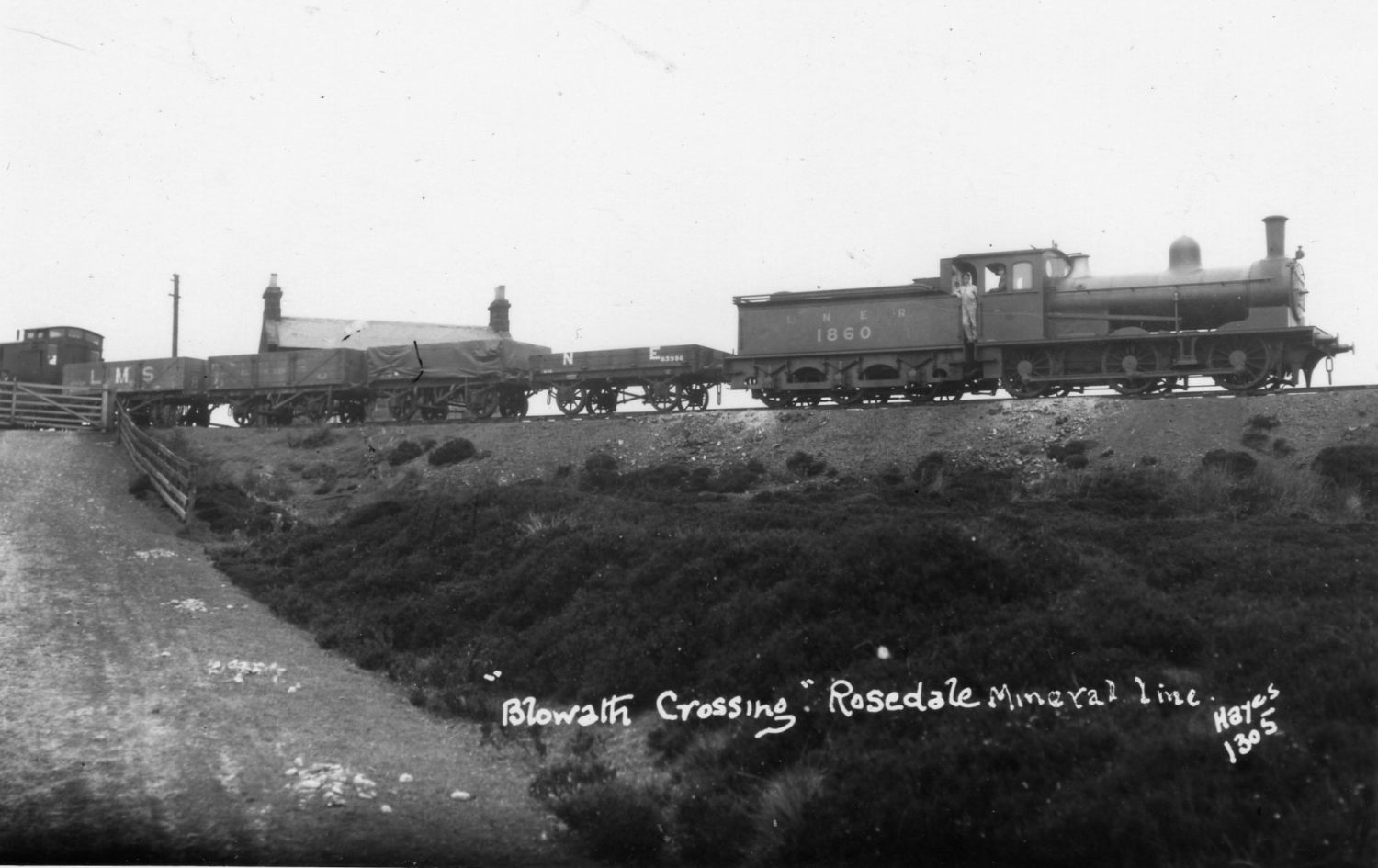
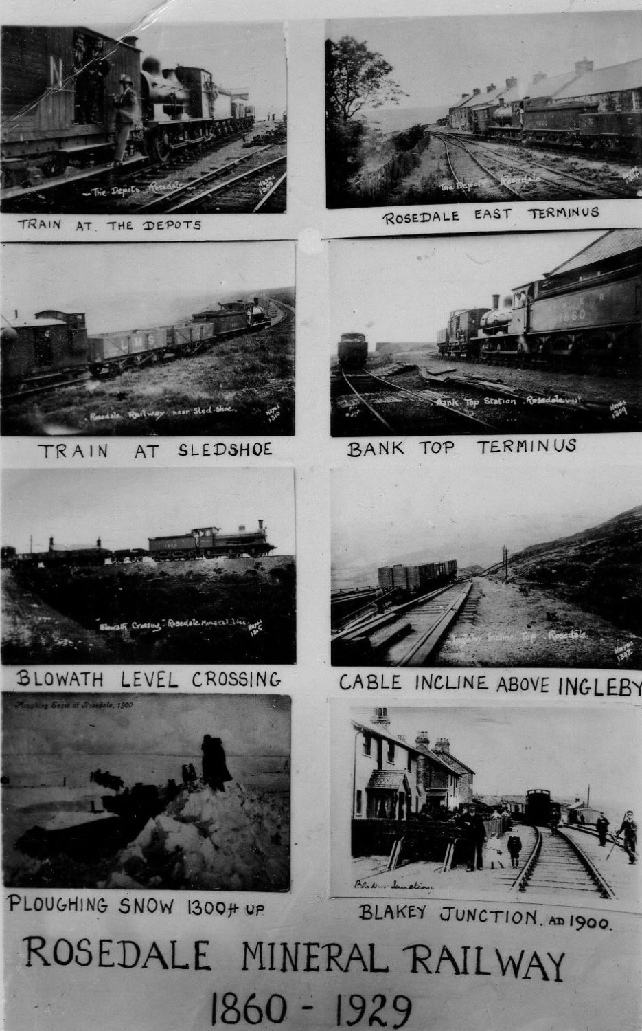
Blowath (or Bloworth) Crossing is one of the highest points of the Rosedale line, situated between the Lion Inn at Blakey and the top of Ingleby Incline. Nowadays it is known as a marker on the Cleveland Way. To the left of the photograph is the ‘break van’ which was used to provide extra brake power for the locomotive.
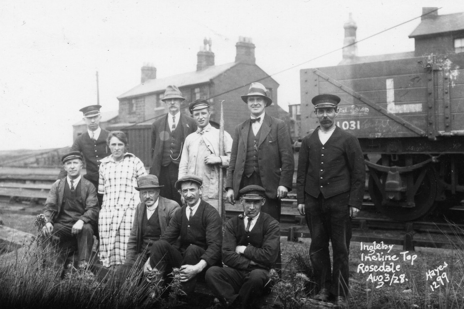
Cottages were built for railway workers at the bottom and top of Ingleby Incline. This photograph shows the cottages at the top, including the workers who lived there. Conditions at these particular cottages were so remote and extreme that they were often referred to as ‘Siberia’.
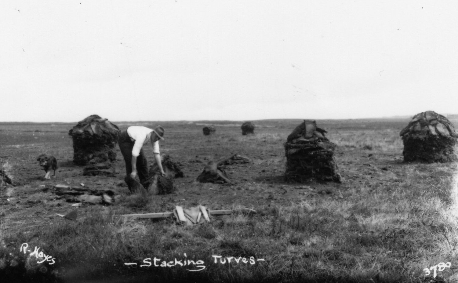
In the past, people fuelled their fires and heated their homes by burning peat turf. Peat was found and harvested from bogs on the moor. The stacks that can be seen on this photograph were formed to help the turf dry out and therefore burn better.
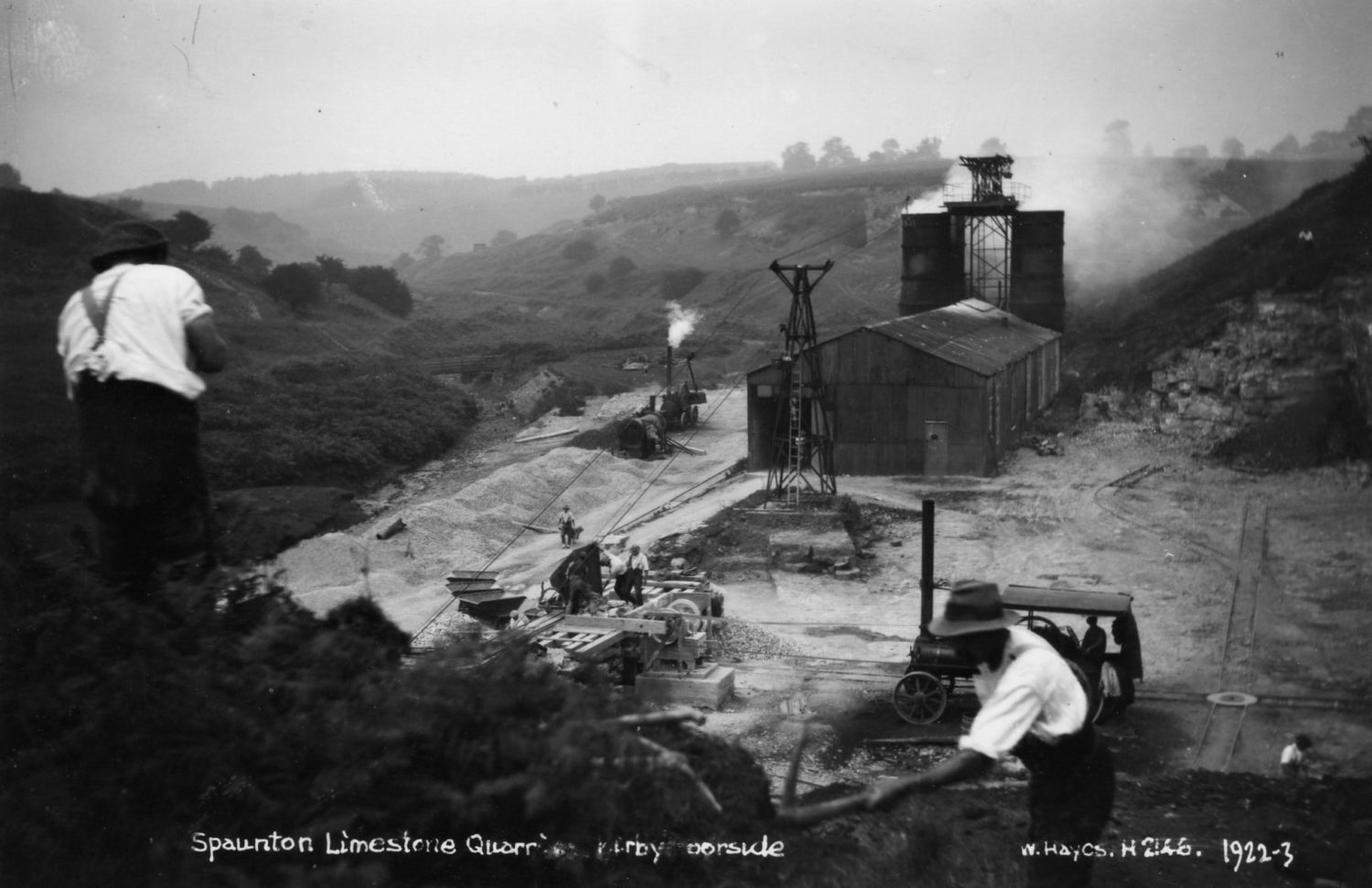
The southern area of the North York Moors was particularly rich in limestone. Spaunton was a prominent site where it was processed, and helped to provided lime for building work and agriculture in the Ryedale area. The kilns at Spaunton were used for the calcining process and can be seen as the double towers in this photograph.
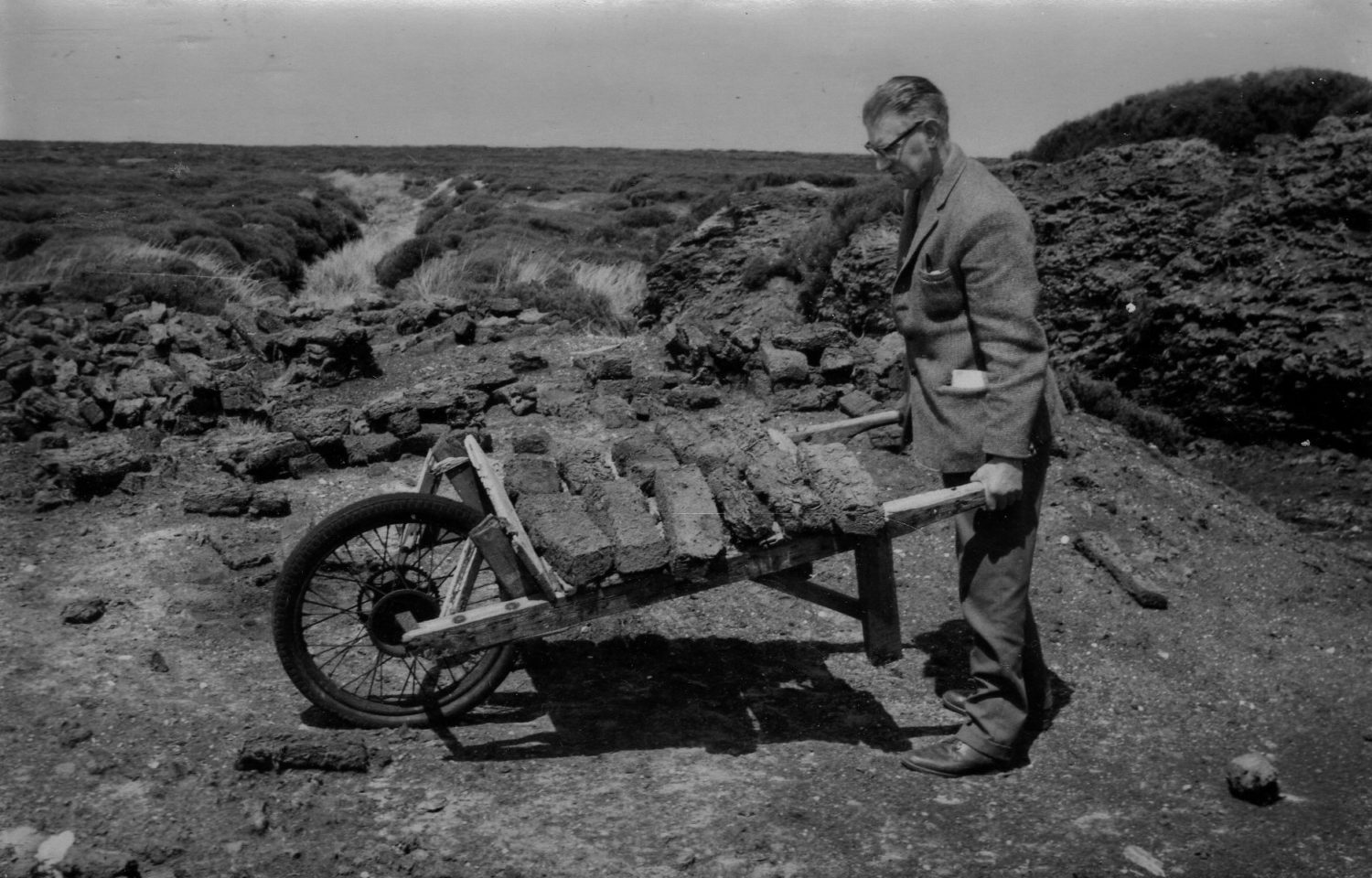
Bert Frank, the first curator at Ryedale Folk Museum, carries a wheelbarrow of peat harvested from Glaisdale moor. Piles of peat can be seen in the background, left to dry out in the good weather.
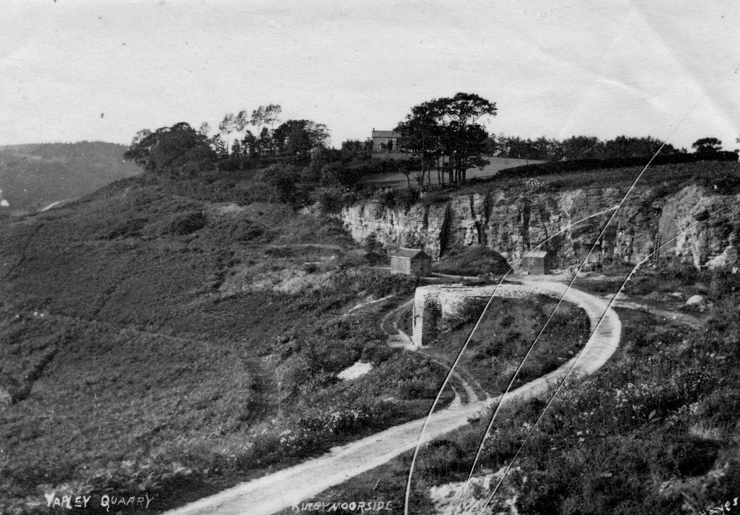
The Yapley quarry site can be found on the road out of Hutton-le-Hole, towards Kirkbymoorside. The remnants of the quarry make up the valley which the river Dove flows through, alongside the Ravenswick estate. What kind of quarry it was is uncertain, though it was probably limestone.
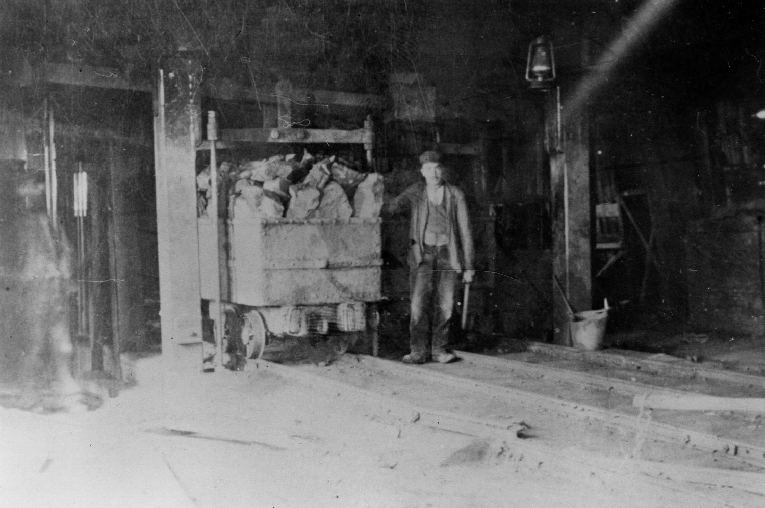
Taken from within the Rosedale mine, this photograph shows a cart full of iron ore ready to be taken and transferred to the railway. Various tools can be seen, such as a bucket, pickaxe and light.
This photograph shows the long line of railway wagons waiting to be filled with iron ore from the calcine kilns. This is at the main Rosedale site, and the tracks will go on to meet up with the main Blakey Junction line.
This collation of photographs provides an overview of the railway system that served the Rosedale mines from 1860 to 1929. It includes the start of the journey at the depots in Rosedale, followed by significant points along the journey such as Sledshoe, Blowath, and Ingleby.
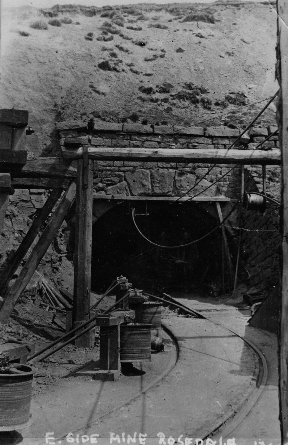
The wagon tracks wind their way into the entrance of the Rosedale East mine. The layout of the timber supports can be seen, as well as the wires used to haul the wagons out of the mine. Wires could also be used as a signalling devise to pass messages to workers within the tunnels.